
AutoCAD Landscape Rendering: Why We Read the DWG Itself
Most AI tools that offer to render your CAD plan, ours included until now, want a picture of it: export a PNG, screenshot the PDF, upload. Then a model looks at the picture and decides what each shape is and where it sits. Today Project Studio stops asking. CAD ↔ Photo reads the AutoCAD .dwg itself.
Francis Karuri
Founder & CTO, Hadaa
 Drawing
Render
Drawing
Render
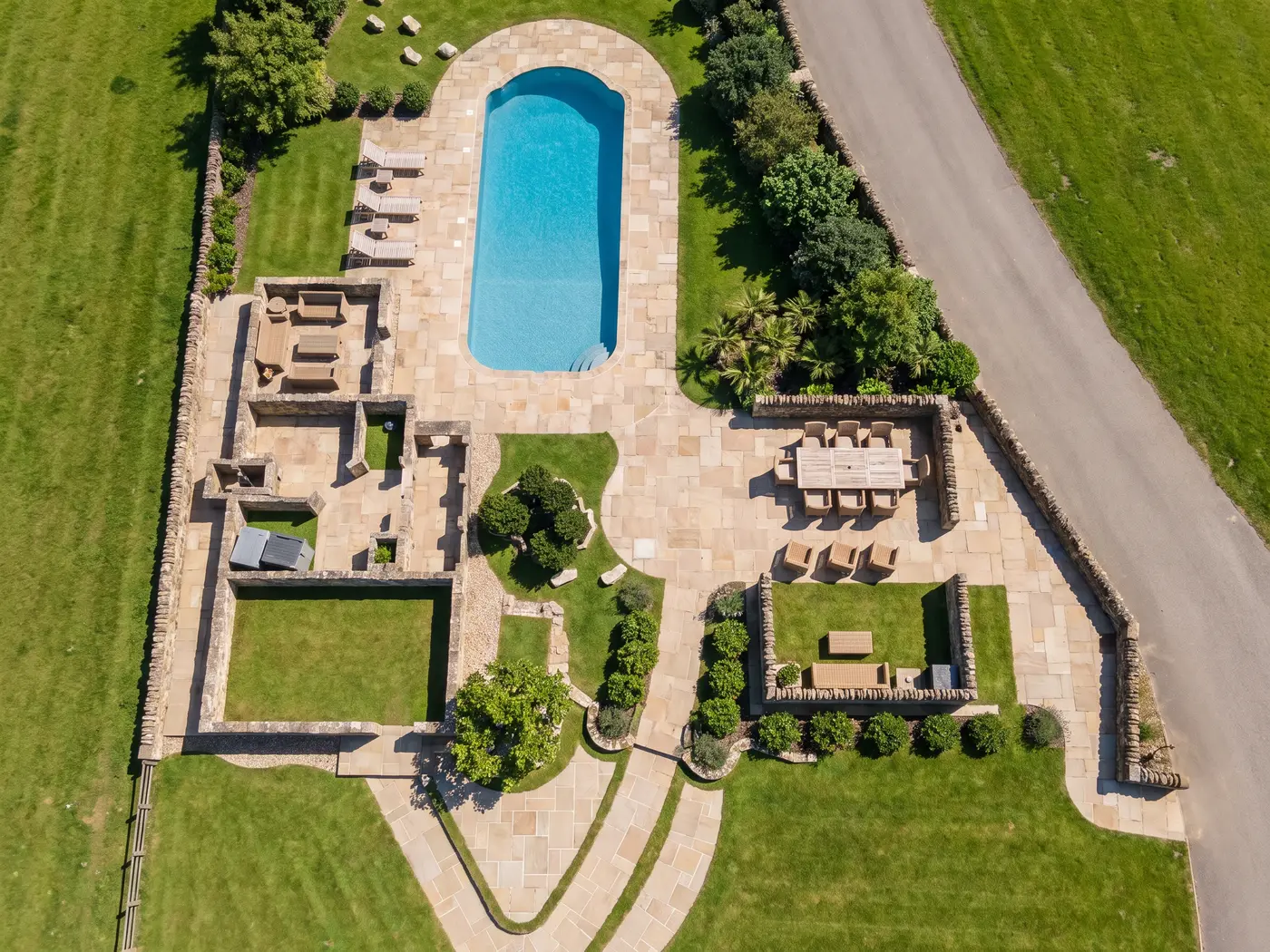
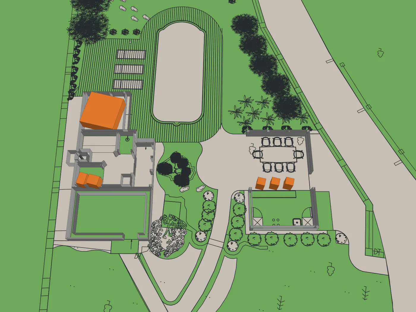
A view drawn from a DWG, and the render made from it. Drag the handle to compare.
The file
Your AutoCAD .dwg, read layer by layer. Nothing is traced off a picture of it.
The model
Beds, paths, walls, fences and trees, built in 3D from the file’s own geometry.
The views
The plan and all four sides in one click, or any shot you frame yourself.
The check
Each render is measured against its drawing — 27 kinds of thing — and made again, up to 3 times, while anything is off. The verdict is shown under it.
CAD ↔ Photo reads your AutoCAD .dwg, builds the garden as a 3D model, renders the plan and its four sides or a view you frame, and checks every render against its drawing, up to 3 times, showing the verdict under it.
What a picture of a plan gets wrong
We tested the picture route on a real residential concept plan, the kind a designer sends a client before the first site meeting. Both renders put the patio on the wrong side of the house. One added a driveway nobody drew. And the check that graded them scored both 88 out of 100, because it compared each render with the model's own reading of the drawing, which was wrong in the same way.
None of that is a rendering problem. It is a reading problem. A picture of a plan is a puzzle: which line is a wall, which hatch is a bed, which circle is a tree and how wide. A model solving that puzzle will sometimes solve it wrong, and confidently.
A DWG is not a picture of the design. It is the design.
The same plan as an AutoCAD file holds everything the picture made us guess. Real units. A layer for every kind of thing: buildings, walks and patios, the driveway, plant beds, fences, trees, labels, spot grades. Every tree, shrub, boulder and chair placed by name, with its size. Nothing has to be read off pixels.
So CAD ↔ Photo never asks a model what the drawing says. Hadaa reads the file, closes the regions the lines bound, names each one by what is inside it first — its hatch, a label written in it, the plants drawn in it — and only then by its layers, and builds the garden as a 3D model you can turn, slide and zoom. Then it pictures that model from each camera, and the image model is handed those pictures as fact. It decides what the paving looks like. It never decides where the paving is.
What the file says, it keeps: a label that gives a height, a size or a material, a roof drawn as a roof plan. What the file does not hold, we say so. Most things have no stated height, so heights are assumed from what each thing is, and every assumption is listed before you spend a credit. A file that doesn’t say its units asks you which. The surfaces the file leaves open are the render's to choose, steered by your brief.
How it works
-
1
Upload the .dwg
Drop the AutoCAD file in beside the site photos. No export, no screenshot. If the file doesn’t say its units, you’re asked.
-
2
Turn the 3D model
Hadaa builds the garden from the file’s own geometry — beds, paths, walls, fences, trees — as a 3D model you can turn, slide and zoom from 20° to 89° above it, and lists every height or roof it assumed.
-
3
Render the views
Generate 5 recommended views — the plan and all four sides — for 45 credits, or frame your own shot for 9.
-
4
Checked against your drawing
Each view is measured against the drawing it came from — 27 kinds of thing, among them the roof, paving, trees, fence, water and lawn — and made again, up to 3 times at no extra cost, while anything is off. The verdict is shown under every render. A view we can’t make is refunded.
Checked by measuring, not by asking
Because each render is an edit of a picture of the 3D model built from your file, it lines up with that picture. That lets us check it without asking a model's opinion. Then everything in view is measured where you drew it: the roof, driveway, bare pad, paving, trees, water, burgundy tree, green tree, shrubs, flowering plants, planting beds, deck, stoop, house walls, fence, low walls and boulders, stepping stones, furniture, fire pit, edging, column, structure, water feature, gravel, hard surface, open ground and lawn. Every tree, burgundy tree, green tree, shrub, flowering plant, fence, stepping stone, piece of furniture, fire pit, column, structure and water feature is looked for on its own, so one that’s missing is named. A render that is off is made again from scratch, up to 3 times at no extra cost. Those re-renders are ours to pay for, not yours.
The verdict is shown under every render: how many things are in place, and what’s off. If no attempt passes, the closest is still delivered, marked “Failed check”; one we couldn’t measure is marked “Not checked”.
And because a drawing is not a photograph of the site, there is Walk around: choose one of your own site photos, drag where you stood on the plan, and the design is rendered into that photograph. The house stays as you photographed it; the garden becomes the one you drew. A walk around isn’t checked against the drawing, since what lies beyond the design comes from your photo.
What it costs, and what it does not do yet
9 credits a view
The plan and all four sides for 45 credits; a view you frame, or a walk around, for 9 credits. A view we can’t make is refunded. On every Project Studio plan and the Project Pass.
Not yet
.dwg only — not .dxf, Revit or SketchUp. Cameras on the 3D model stay at drone height, 20° to 89° down. It runs in the browser, not the phone apps.
Everything in detail, with the questions designers ask: CAD ↔ Photo: DWG to photorealistic render →
Frequently Asked Questions
Can Hadaa render an AutoCAD DWG file directly?
Which CAD formats does it read?
How much does it cost?
Does it work for eye-level views?
Bring the next client's DWG
Show them a photograph of the garden you drew.
CAD ↔ Photo is in every Project Studio plan, alongside every other engine.
Start with Project Studio →

